欢迎访问林业科学,今天是

林业科学 ›› 1998, Vol. 34 ›› Issue (2): 1-10.

• 论文及研究报告 •    下一篇

中国沙质荒漠化土地监测评价指标体系*

高尚武1,王葆芳1,朱灵益1,王君厚2,张玉贵3   

  1. 1. 中国林业科学研究院林业研究所 北京 100091
    2. 林业部调查规划设计院 北京 100714
    3. 中国林业科学研究院资源信息研究所 北京 100091
  • 收稿日期:1997-11-27 出版日期:1998-03-25 发布日期:1998-03-25

MONITORING AND EVALUATION INDICATOR SYSTEM ON SANDY DESERTIFICATION OF CHINA

Shangwu Gao1,Baofang Wang1,Lingyi Zhu1,Junhou Wang2,Yugui Zhang3   

  1. 1. The Research Institute of Forestry, CAF Beijing 100091
    2. Academy of Forest Inventory Planning and Design, Ministry of Forestry Beijing 100714
    3. The Research Institute of Forest Resource Information, CAF Beijing 100091
  • Received:1997-11-27 Online:1998-03-25 Published:1998-03-25

摘要:

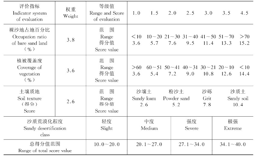
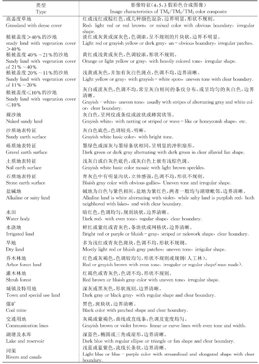
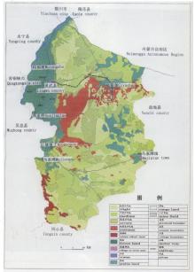
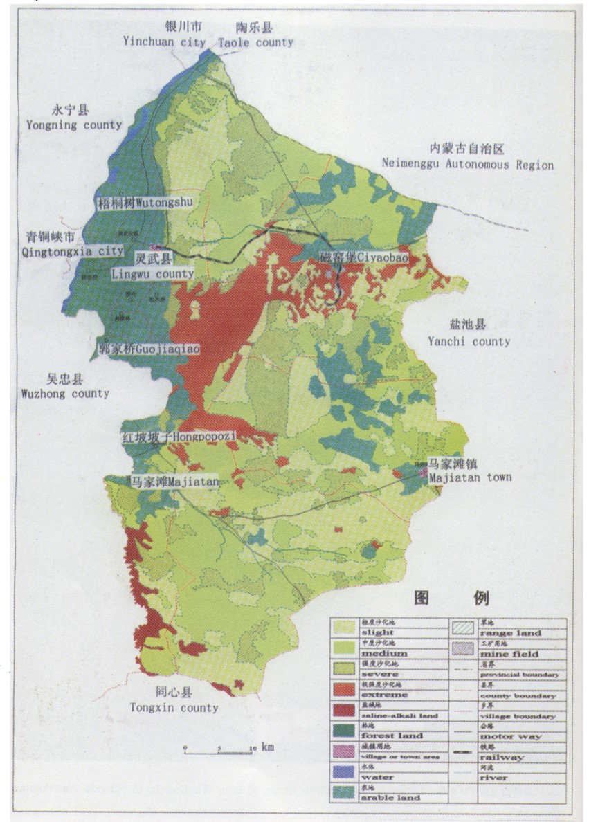
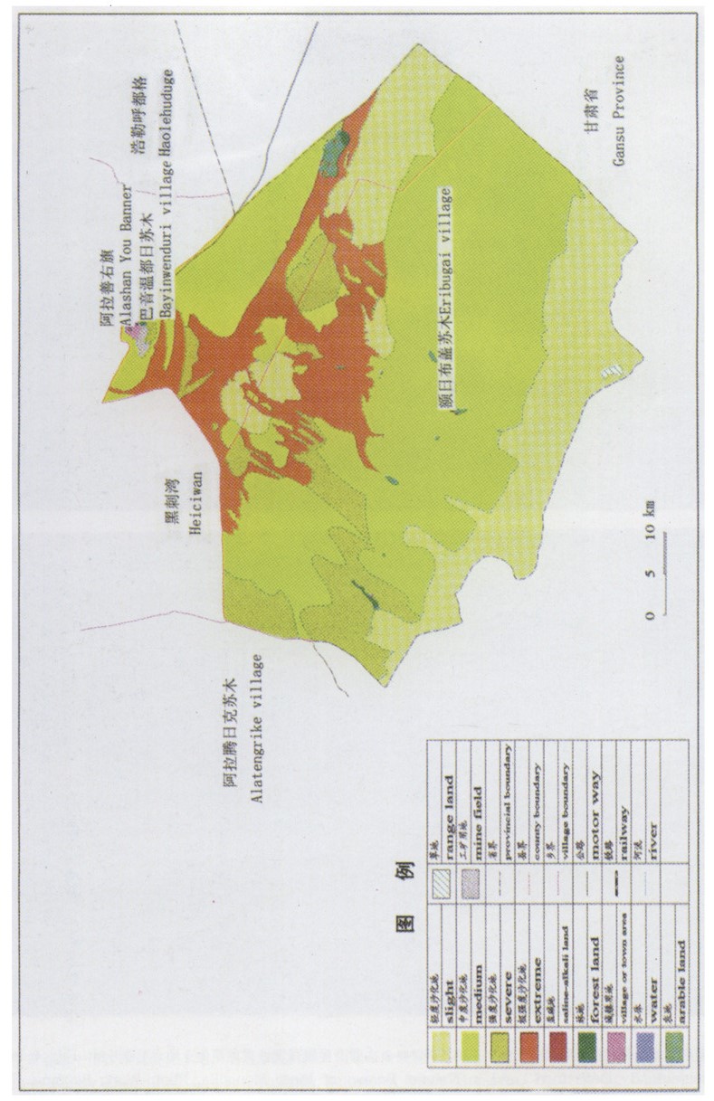
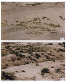
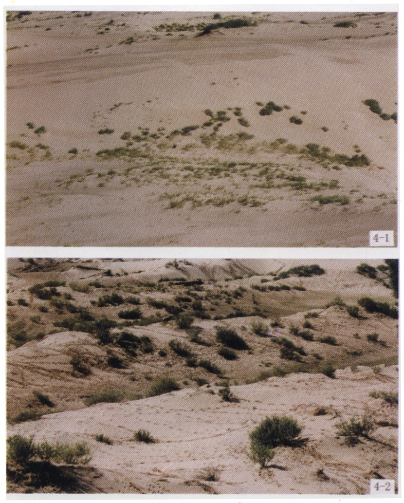
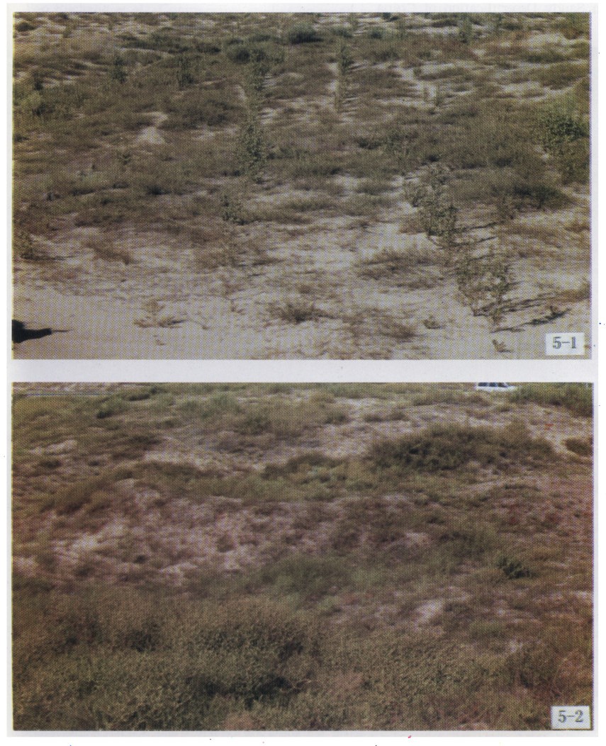
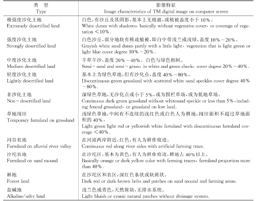
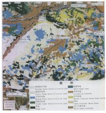
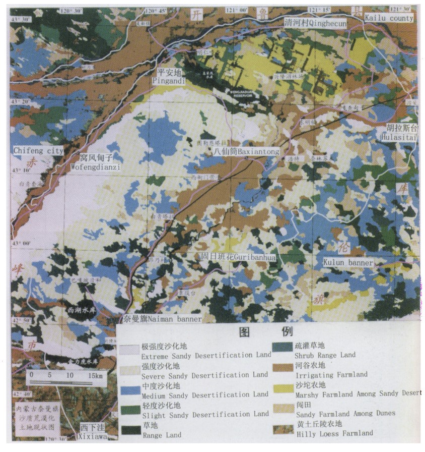
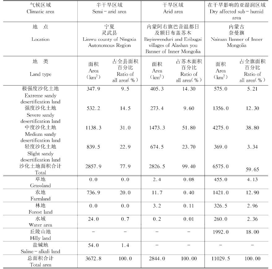
中国是受荒漠化影响较重的国家,保护环境资源可持续发展,及时掌握荒漠化时空变化信息,有效的实施宏观管理,是荒漠化治理的主要内容。为此,依据地表形态和生态状况的变化确定植被盖度、裸沙地占地百分比和土壤质地3项评价指标,从不同侧面指示特定土地的生产力,并将各指标因子量化,给出沙质荒漠化(风蚀荒漠化、沙化)现状综合评价模型。根据国情和沙质荒漠化遥感监测需要,这次提出的沙质荒漠化现状评价指标比较直观、便捷、实用,可以通过卫星影像目视解译或用数字影像在微机上用图像软件按象元水平解译遥感图像、制图。通过在三个不同气候区域的野外调查,验证利用遥感信息获取数据的可行性,证明沙质荒漠化监测评价指标体系适用于遥感和计算机技术进行分类评估沙化的空间分布。

关键词: 荒漠化, 沙质荒漠化, 评价指标

Abstract:

China is a country seriously affected by desertification it is the main content of combating desertification to protect the environmental resources forits sustainable development, to keep informed about the spatial and temporal changes of desertification for an effective implementation of macro control and management. For this purpose, the coverage of vegetation, the occupation ratio of bare sandy land and the soil texture are determined as three evaluation indicators of sandy desertification degree, depending on the configuration and ecotope of the earth surface. These 3 indicaltors show the productivity of a specific land from different aspects. A comprehensive mathematical model to evaluate sandy desertification degree was set up. According to the national conditions and the requirements of desertification monitoring by remote sensing, these evaluation indicators proposed in this paper audio-visual are, convenient and practical, which can be used not only to evalue the desertification degree of land but also to draw desertification distribution maps through visual interpretation on satellite images or on computer screen with digital imagety on pixel level. This monitoring and evaluation indicator system is testified to be applicable to classification and assessment on spatial distribution of desertification by using remote sensing and computer techniques after field investigation and verification in arid, semi-arid and dry affected sub-humid areas.

Key words: Desertification, Sandy desertification, Evaluation indicator