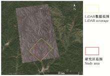
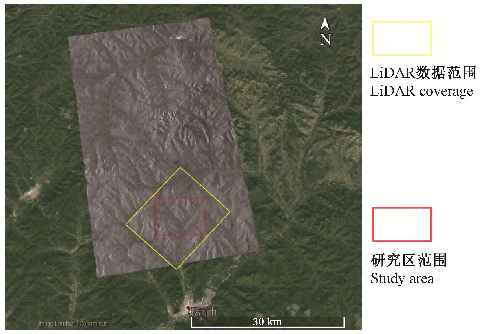
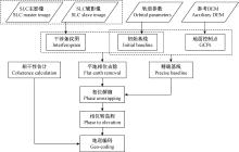
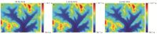
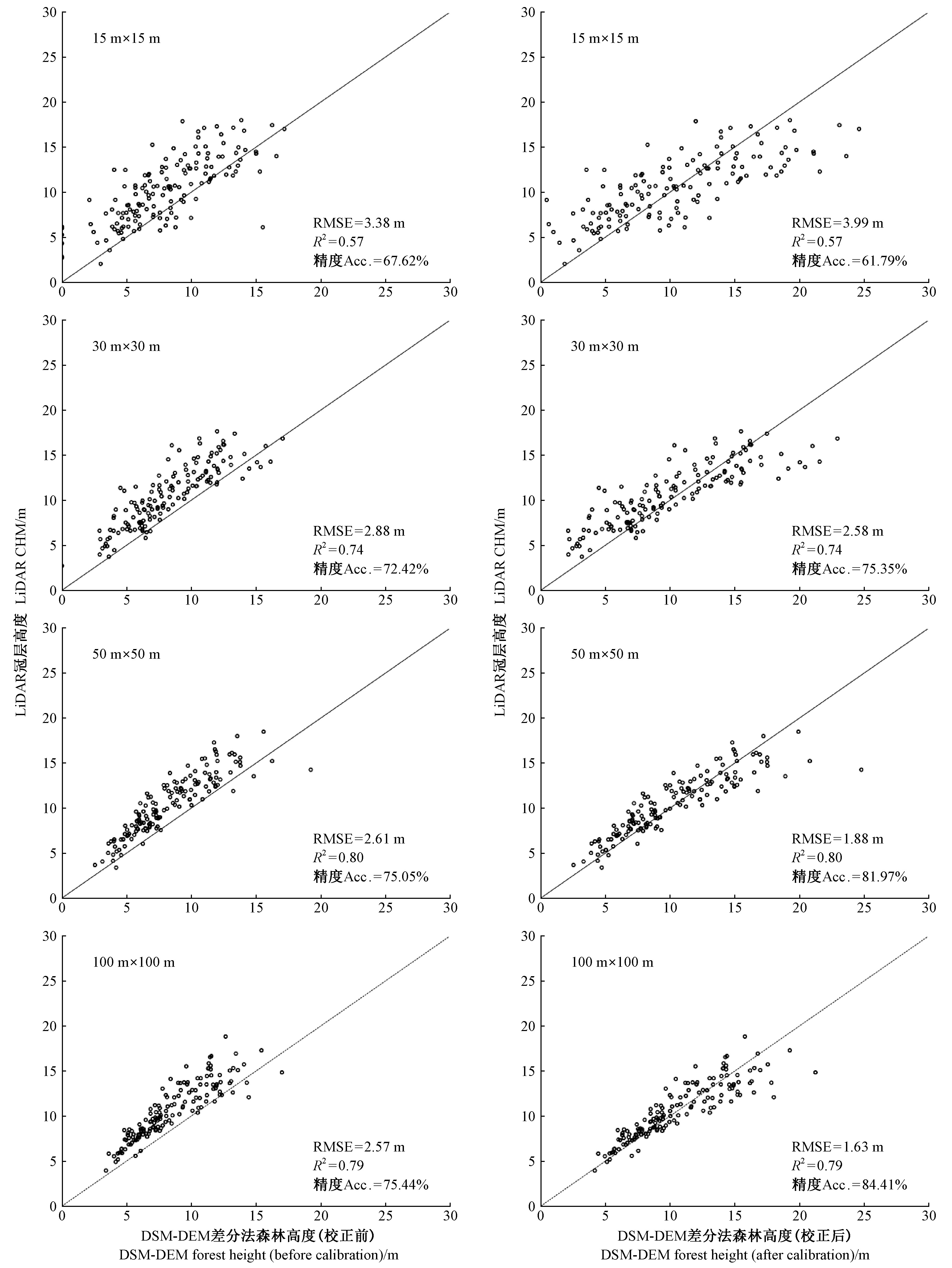
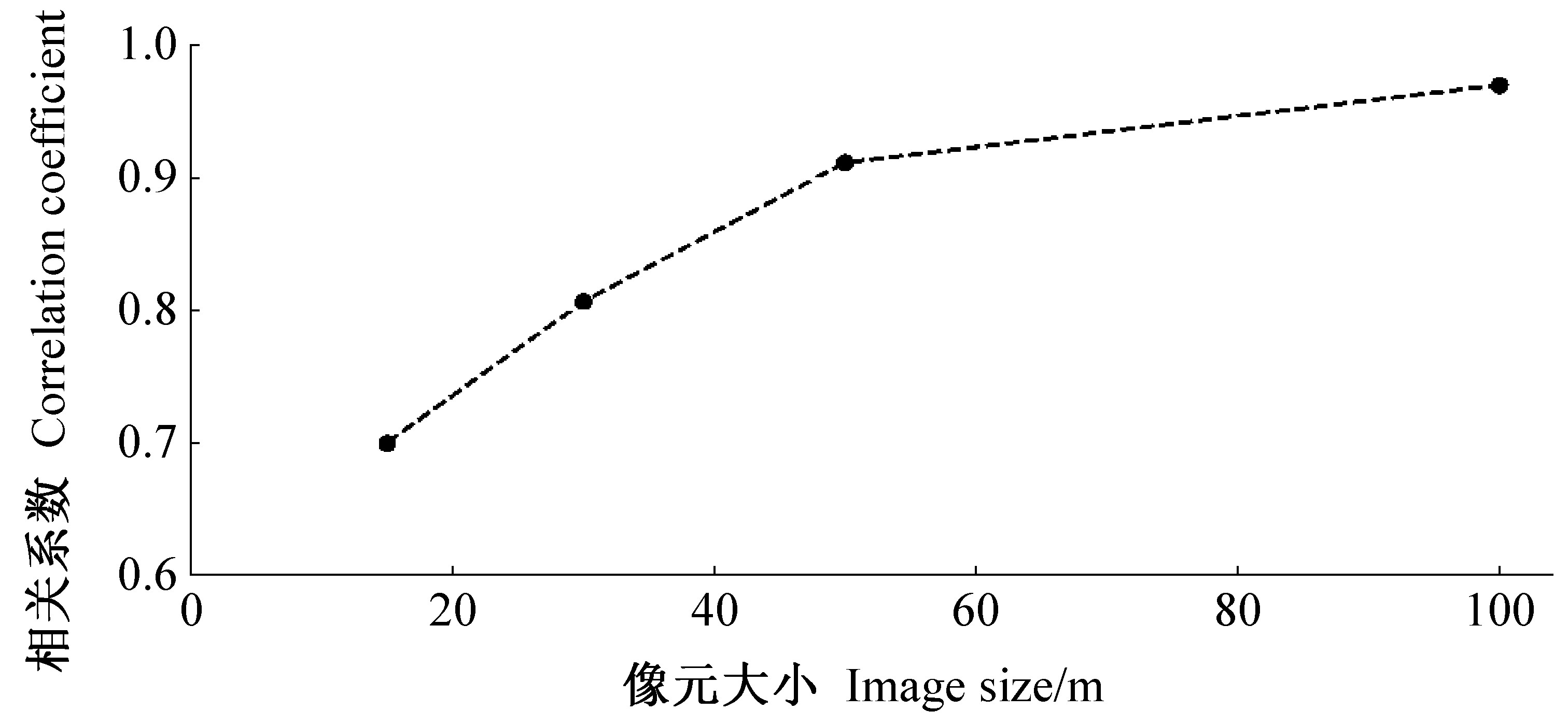
|
陈尔学, 李增元, 庞勇, 等. 基于极化合成孔径雷达干涉测量的平均树高提取技术. 林业科学, 2007. 43 (4): 66- 70.
|
|
Chen E X , Li Z Y , Pang Y , et al. Polarimetric synthetic aperture radar interferometry mean tree height extraction technique. Scientia Silvae Sinicae, 2007. 43 (4): 66- 70.
|
|
冯琦, 陈尔学, 李增元, 等. 机载X-波段双天线InSAR数据森林树高估测方法. 遥感技术与应用, 2016. 31 (3): 551- 557.
|
|
Feng Q , Chen E X , Li Z Y , et al. Forest height estimation from airborne X-band single-pass InSAR data. Remote Sensing Technology and Application, 2016. 31 (3): 551- 557.
|
|
穆喜云. 2015.森林地上生物量遥感估测方法研究.呼和浩特:内蒙古农业大学博士学位论文.
|
|
Mu X Y. 2015. A study on the estimating method of forest above ground biomass based on remote sensing data. Hohhot: PhD thesis of Inner Mongolia Agricultural University.[in Chinese]
|
|
Chen H , Cloude S R , Goodenough D G . Forest canopy height estimation using TanDEM-X coherence data. IEEE Journal of Selected Topics in Applied Earth Observations & Remote Sensing, 2016. 9 (7): 3177- 3188.
|
|
Cloude S R. 2010. Polarisation: applications in remote sensing. UK: Oxford University Press.
|
|
Cloude S R , Chen H , Goodenough D G . Forest height estimation and validation using TanDEM-X PolInSAR. IEEE Geoscience and Remote Sensing Symposium, 2014. 1889- 1892.
|
|
Krieger G , Moreira A , Fiedler H , et al. TanDEM-X:a satellite formation for high-resolution SAR interferometry. IEEE Transactions on Geoscience & Remote Sensing, 2007. 45 (11): 3317- 3341.
|
|
Kugler F , Schulze D , Hajnsek I , et al. TanDEM-X Pol-InSAR performance for forest height estimation. IEEE Transactions on Geoscience & Remote Sensing, 2014. 52 (10): 6404- 6422.
|
|
Olesk A , Praks J , Antropov O , et al. Interferometric SAR coherence models for characterization of hemiboreal forests using TanDEM-X data. Remote Sensing, 2016. 8 (9): 700.
doi: 10.3390/rs8090700
|
|
Olesk A , Voormansik K , Vain A , et al. Seasonal differences in forest height estimation from interferometric TanDEM-X coherence data. IEEE Journal of Selected Topics in Applied Earth Observations & Remote Sensing, 2015. 8 (12): 5565- 5572.
|
|
Praks J , Hallikainen M , Antropov O , et al. Boreal forest tree height estimation from interferometric TanDEM-X images. IEEE Geoscience and Remote Sensing Symposium, 2012. 1262- 1265.
|
|
Sadeghi Y , St-Onge B , Leblon B , et al. Mapping forest canopy height using TanDEM-X DSM and airborne LiDAR DTM. IEEE Geoscience and Remote Sensing Symposium, 2014. 76- 79.
|
|
Seymour M S , Cumming I G . Maximum likelihood estimation for SAR interferometry. IEEE Geoscience and Remote Sensing Symposium, 1994. 2272- 2275.
|
|
Soja M J , Persson H J , Ulander L M H . Estimation of forest biomass from two-level model inversion of single-pass InSAR data. IEEE Transactions on Geoscience & Remote Sensing, 2015. 53 (9): 5083- 5099.
|
|
Soja M J , Ulander L M H . Digital canopy model estimation from TanDEM-X interferometry using high-resolution LiDAR DEM. IEEE Geoscience and Remote Sensing Symposium, 2013. 165- 168.
|
|
Soja M J , Ulander L M H . Two-level forest model inversion of interferometric TanDEM-X data. 10th European Conference on Synthetic Aperture Radar, 2014. 1- 4.
|
|
Treuhaft R N , Madsen S N , Moghaddam M , et al. Vegetation characteristics and underlying topography from interferometric radar. Radio Science, 1996. 31 (6): 1449- 1485.
doi: 10.1029/96RS01763
|